Using APIs to Integrate Location Experiences
Introduction
With API's and SDK create flexible experiences integrating the map anywhere. Integrating map data into the IFE GUI or external data into the map is essential to providing a great passenger experience.
API’s have the ability to:
Integrate content and augmented reality with 2D and 3D visualization
Integrate directions and routing for destination and airport services
Showcase travel services within street and satellite imagery
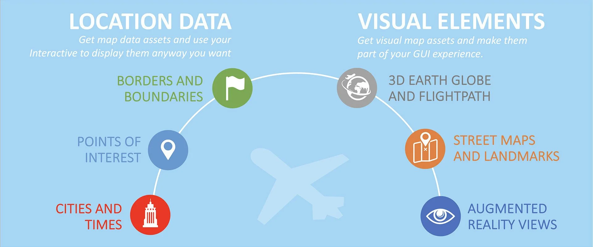
Location Data
Get map data assets and use your interactive to display them any way you want.
Borders and Boundaries
Border and boundary JSON returns bounded regions names, distances and estimated flying time based the current aircraft position and flight direction. Features include:
Type: Could be implemented with Country Borders and/or with Satellite Coverage maps.
Bounded regions: Countries/Territories or satellite coverage areas.
Timing: Estimate how soon you will be over certain geographical area.
Style: Integrator defines the visual appearance of your alert or data.
Example: “You are crossing US/Canada border in 10 min” or “Your internet connectivity may become spotty in 5 min, save your work”
Points of Interest
Point of Interest JSON information for a specific location or geofenced area around the current aircraft position. Features include:
City list: Get POIs around you with their details including descriptions, images as well distance and direction from the aircraft.
Local time: Name of the POI and text description is localized where possible if a language other than English is available and requested.
Distance and direction: Geolocated and geocoded data in relationship to the current aircraft location.
Example: “Grand Canyon is 58 miles through the left window, click to read more about it”
Cities and Times
Cities and Times JSON structured information for a specific destination, major cities or geofenced area around the current aircraft position. Features include:
City list: Get a list of major cities nearby with distances and directions from your current location.
Local time: Get local times in these cities.
Distance and direction: Geolocated and geocoded data in relationship to the current aircraft location.
Example: “Hong Kong, 2496 miles to the East, Local Time: 4:53PM”
Visual Elements
Get visual map assets and make them part of your GUI experience.
3D Globe and Flight Progress
Globe and flight path map assets are part of our implementation that used OpenGL to render interactive maps from satellite tiles. Features include:
Map objective: Decide what map layers and flight path view elements to display and how to animate it.
Auto-play script: Interactive or scripted with customizable auto-play sequence depicting various map and informatiomn screens based on the pre-configured instructions and real-time (or estimated) flight phase information.
Size and placement: Control the size and placement of the 3D Globe on any of your interactive pages.
Style: Blend globe into your GUI and define the visual appearance of the map.
Street Maps and Landmarks
Street map assets and landmarks are part of our implementation that uses OpenGL to render interactive maps from satellite tiles. Features include:
Map objective: Decide what street map city to display.
Zoom level: Display specific location at any zoom level or set up zoom amination.
Size and placement: Control the size and placement of the street map on any of your interactive pages. Allow passenger to open full street map experience.
Style: Blend street map into your GUI with specific POI icons on the map.
Augmented Reality Views
Augmented reality view assets are part of our implementation that used OpenGL to render interactive maps from satellite tiles. Features include:
Cockpit: Cockpit/Pilot H.U.D. view.
Aircraft 360: Close up of your aircraft.
Window: Passenger Left/Right Window views.
Follow Plane: Follow aircraft along flight path in 3D.